
Redco Qinglin Bay Project (Hangzhou, China)
Release time
:2024-01-05 16:43:22 Views:
Project Start Date: May of 2021
Project Location: Yangdai Village, Hangzhou, China
Project Scope: Regional Area of Yangdai Village
Total Construction Area: 85,441.7 m2 (Over 919,686.80 sqft)
Project Overview:
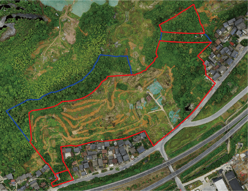
The Redco Qinglin Bay project is located in an area with hilly terrains. The highest point in the north reaches an elevation of approximately 123.36 meters (~ 404.72 ft) and gradually descends southward to the highway intersection, where the elevation is around 58.68 meters (~ 192.52 ft). This creates a north-south elevation difference of approximately 71.11 meters (~233.30 ft) . The terrain slopes span across the east and west as well; the low-lying area on the west side has an elevation of about 74.67 meters (~ 244.98 ft), while the lower area on the east side has an elevation of approximately 67.69 meters (~222.08 ft).
Project Details:


Integration of Terrain Model and Building Model
Project Location: Yangdai Village, Hangzhou, China
Project Scope: Regional Area of Yangdai Village
Total Construction Area: 85,441.7 m2 (Over 919,686.80 sqft)
Project Overview:
The Redco Qinglin Bay project is located in an area with hilly terrains. The highest point in the north reaches an elevation of approximately 123.36 meters (~ 404.72 ft) and gradually descends southward to the highway intersection, where the elevation is around 58.68 meters (~ 192.52 ft). This creates a north-south elevation difference of approximately 71.11 meters (~233.30 ft) . The terrain slopes span across the east and west as well; the low-lying area on the west side has an elevation of about 74.67 meters (~ 244.98 ft), while the lower area on the east side has an elevation of approximately 67.69 meters (~222.08 ft).
Aerial View of the Redco Qinglin Bay (Highlighted Area Indicates Project Boundaries)
Project Details:
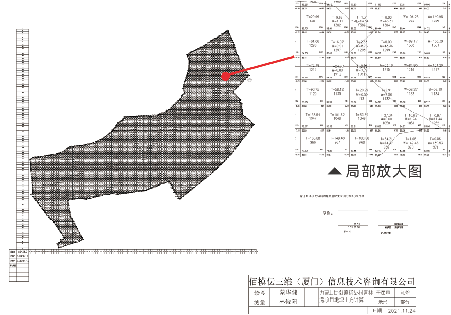
Bimodeling exploited several drones to gather data from the scanned area. The terrain model allowed for direct reading of elevation, elevation differences, and cut-and-fill volumes at different locations, facilitating simulation and analysis. Meanwhile, it also facilitated in providing various earthwork balance comparison plans during the early design phase in an efficient and accurate manner.
By integrating the terrain model with the BIM model, Bimodeling could intuitively optimize earth and stone retaining walls, aiding in vertical analysis of the site and construction drawing design.
Earthwork Measurement Results
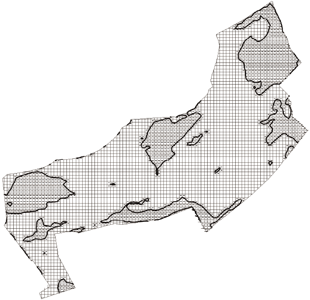
Excavation and Filling Area Diagram
Integration of Terrain Model and Building Model